

GIS
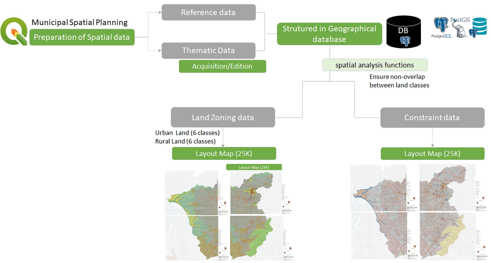
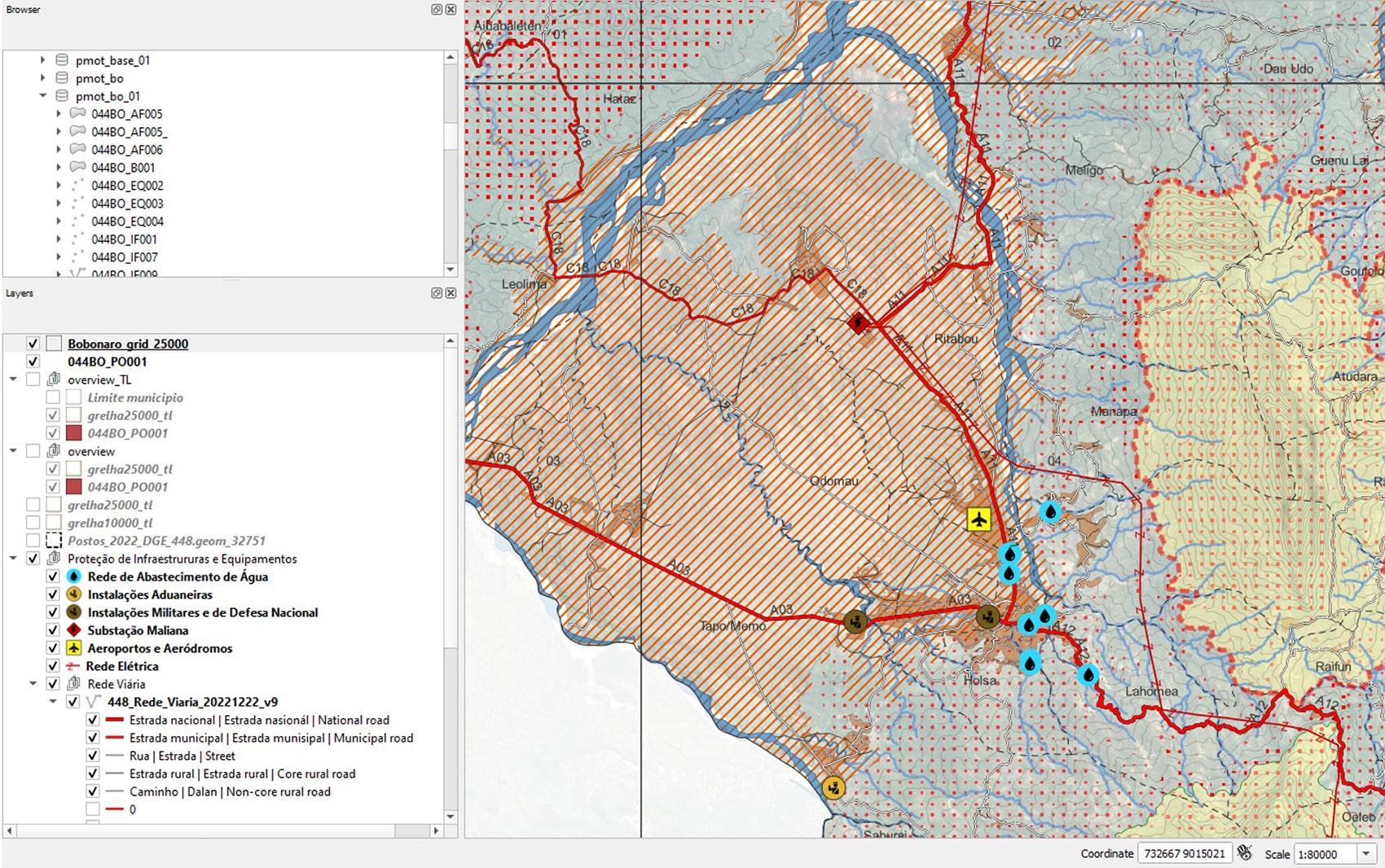
NLA has been favouring digital solutions where the integration of Building Information Modelling (BIM) and Geographic Information Systems (GIS) is a priority. In developing our projects, the geographic context allows us to ensure a more rigorous quantitative and spatial approach in decision making, allowing for the creation of a more integrated architecture in its context, better suited to existing systems and more sustainable. Territorial management instruments particularly benefit from this integration, for NLA has developed Municipal Plans for Spatial Planning, Urbanization Plans or Detailed Plans based on these technologies. The use of Free and Open Source Software (FOSS) for the development of plans with the implementation of geographic databases in PostgreSQL / PostGIS, combined with QGIS software and spatial analysis tools have allowed the implementation of dedicated, robust, and innovative methodologies. This allows NLA to develop spatial planning projects at several different planning levels, not only nationally but also internationally, with the necessary information for land use planning decisions.